A boundary dispute with a neighbour is one of the most stressful and expensive experiences a property owner can face. What starts as a disagreement over a fence or a few inches of garden can quickly spiral into formal legal proceedings that cost tens of thousands of pounds and take years to resolve. Understanding how boundaries work — legally and practically — and knowing when to get professional help can make the difference between a swift resolution and a protracted legal battle.
How Are Property Boundaries Defined?
In England and Wales, property boundaries are defined primarily by the title documents — the deeds, conveyances, and transfer documents that have governed the property over the years. When a property is registered with HM Land Registry (as virtually all properties are today), the title plan shows the general boundary of the registered title, typically based on an OS map.
Critically, the Land Registry title plan does not define the precise legal boundary. It shows only the general extent of the registered property. The precise legal boundary is determined by the original conveyance documents — and in older properties, these can be vague, inconsistent, or simply lost.
This is why boundary disputes arise: two neighbours, both looking at their respective title plans, may each legitimately believe that they own the same strip of land.
Common Causes of Boundary Disputes
- Fence and wall movements — fences deteriorate and get replaced; sometimes not in exactly the right position
- Development and extensions — building works on one property that are alleged to encroach over the boundary
- Overgrown vegetation — trees, hedges, and shrubs growing across assumed boundary lines
- Adverse possession claims — a neighbour claiming ownership of land they have occupied for many years
- Ambiguous historic deeds — old title documents that do not clearly describe the boundary
- Right of way disputes — disagreements about access rights across land
Steps to Resolving a Boundary Dispute
Step 1: Check Your Title Documents
Start by obtaining all available title documents from HM Land Registry (available online) and, if the property was registered before approximately 1980, any underlying title deeds held by your solicitor. Look for any description or plan that might shed light on where the boundary runs.
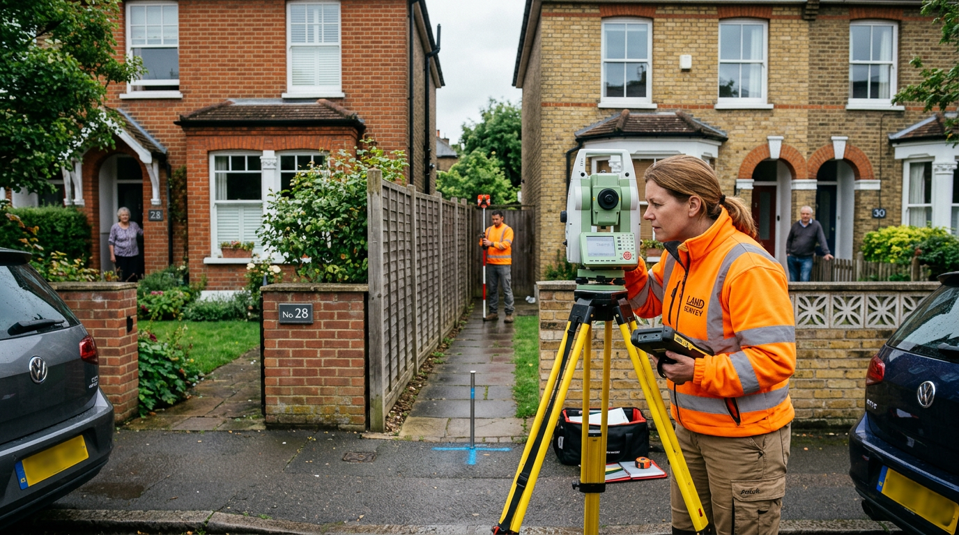
Step 2: Instruct a Boundary Surveyor
A specialist boundary surveyor can:
- Review all available title documents and deeds
- Carry out a measured survey of the land in question
- Examine physical features (walls, fences, hedges) and their history
- Interpret Ordnance Survey mapping and aerial photography
- Produce a detailed boundary report setting out their conclusions
This report may be enough to resolve the dispute, or it may be used as expert evidence in subsequent proceedings.
Step 3: Negotiate Directly
In many cases, once both parties have seen an independent professional assessment of where the boundary lies, direct negotiation between the neighbours — or their solicitors — can produce a practical agreed solution. Agreeing on a determined boundary (registered with Land Registry) gives both parties certainty going forward.
Step 4: Mediation
If direct negotiation fails, property mediation is an effective alternative to litigation. A trained mediator facilitates a structured negotiation between the parties, aiming for a voluntary agreed solution. Mediation is significantly cheaper and quicker than court proceedings, and the outcome — if agreed — can be given legal effect.
Step 5: Formal Legal Proceedings
As a last resort, boundary disputes can be referred to:
- The First-tier Tribunal (Property Chamber) — for applications to determine the exact line of a registered boundary
- The County Court or High Court — for claims involving trespass, nuisance, or declarations of title
Court proceedings in boundary disputes are extremely expensive — costs of £30,000–£100,000+ per side are not uncommon in contested cases. Both courts now take a dim view of parties who fail to consider or engage in mediation before issuing proceedings.
"The most valuable thing I can do in a boundary dispute is give the client an honest, early assessment of the strength of their position. In my experience, the majority of boundary disputes can be resolved before they reach tribunal — but only if both parties are willing to engage with a properly evidenced professional opinion, rather than entrenching around their own beliefs."
The Party Wall Act and Boundary Disputes
It's important to distinguish between boundary disputes and party wall matters. The Party Wall etc. Act 1996 governs works to shared walls and excavations near boundaries — it does not resolve disputes about where a boundary lies. However, in some cases, uncertainty about the position of a party wall or shared boundary can give rise to both types of issue simultaneously.
If you are carrying out works that are close to or might affect the boundary, you may need both a party wall surveyor (to manage the notice and agreement process under the Act) and a boundary surveyor (to establish precisely where the relevant boundary falls).
Key Points to Remember
- The Land Registry title plan does not show the precise legal boundary
- Get early professional advice before writing to your neighbour or instructing solicitors
- Mediation is usually far cheaper and quicker than court proceedings
- An agreed "determined boundary" registered with Land Registry gives long-term certainty
Facing a Boundary Dispute?
Our experienced RICS surveyors provide boundary surveys, expert reports, and expert witness services for property disputes across London and England and Wales.
Get in Touch Boundary Survey Services